
Spatial SQL, with a map attached.
Write PostGIS the way you always have. Then switch the result to Map and see it, instantly, on a basemap that lives on your Mac. No export, no QGIS round trip, no upload.
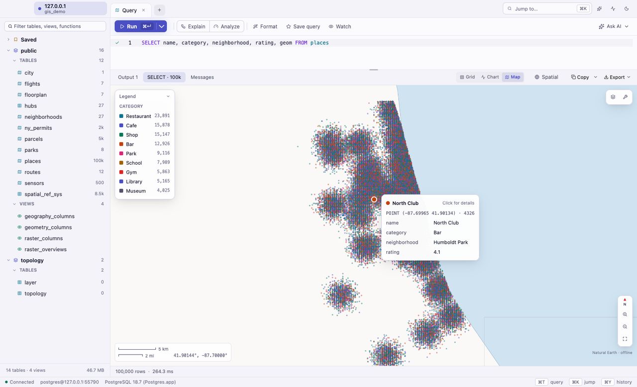
Every geometry, every result.
Any result or table with a geometry or geography column gets a Map tab. Points, lines and polygons draw fast enough that hundreds of thousands of features pan and zoom smoothly.
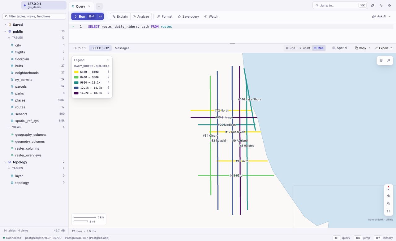
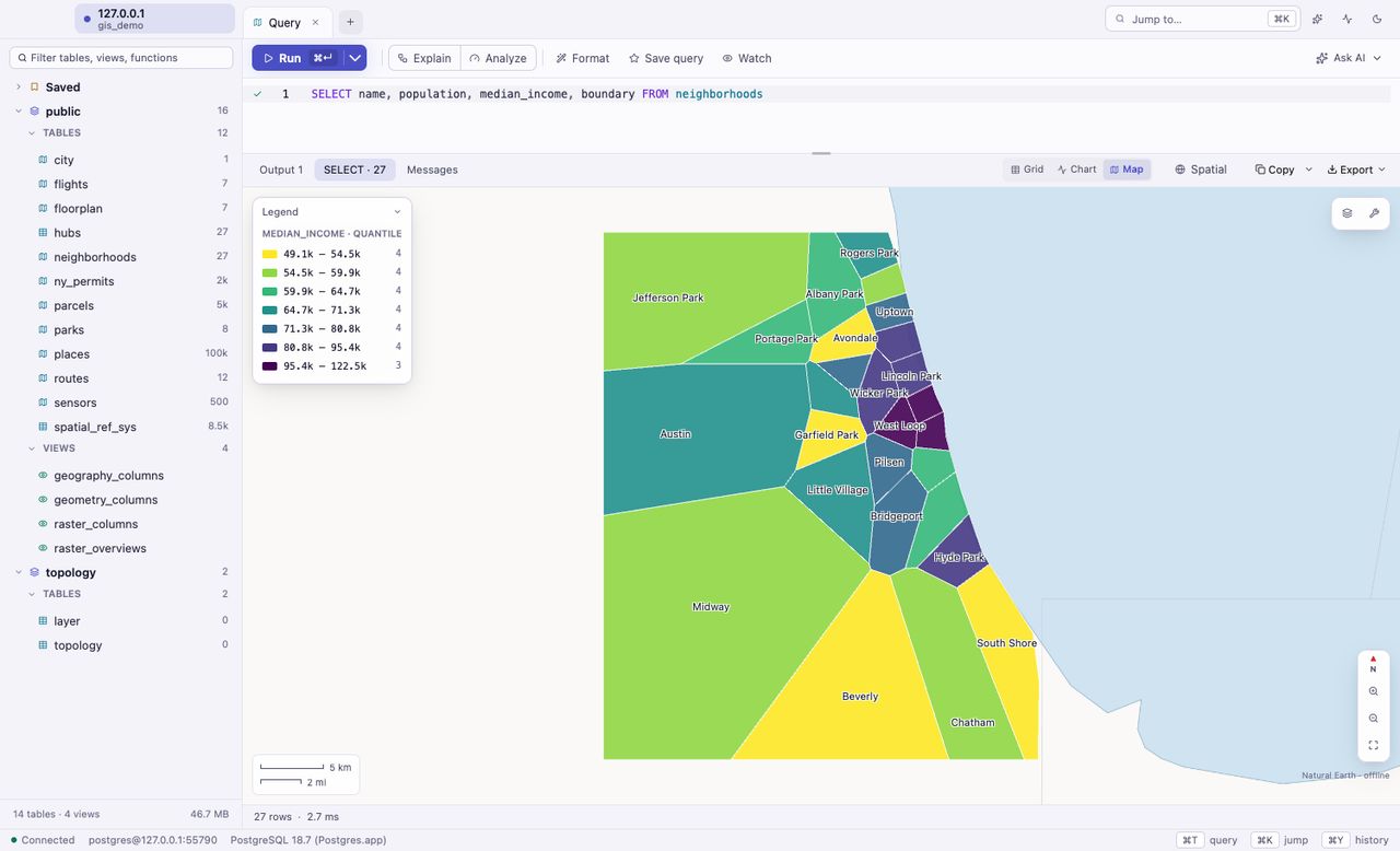
Color by any column
Categories get distinct colors, numbers a smooth ramp, with a legend that shows the range and counts.
Hover and select
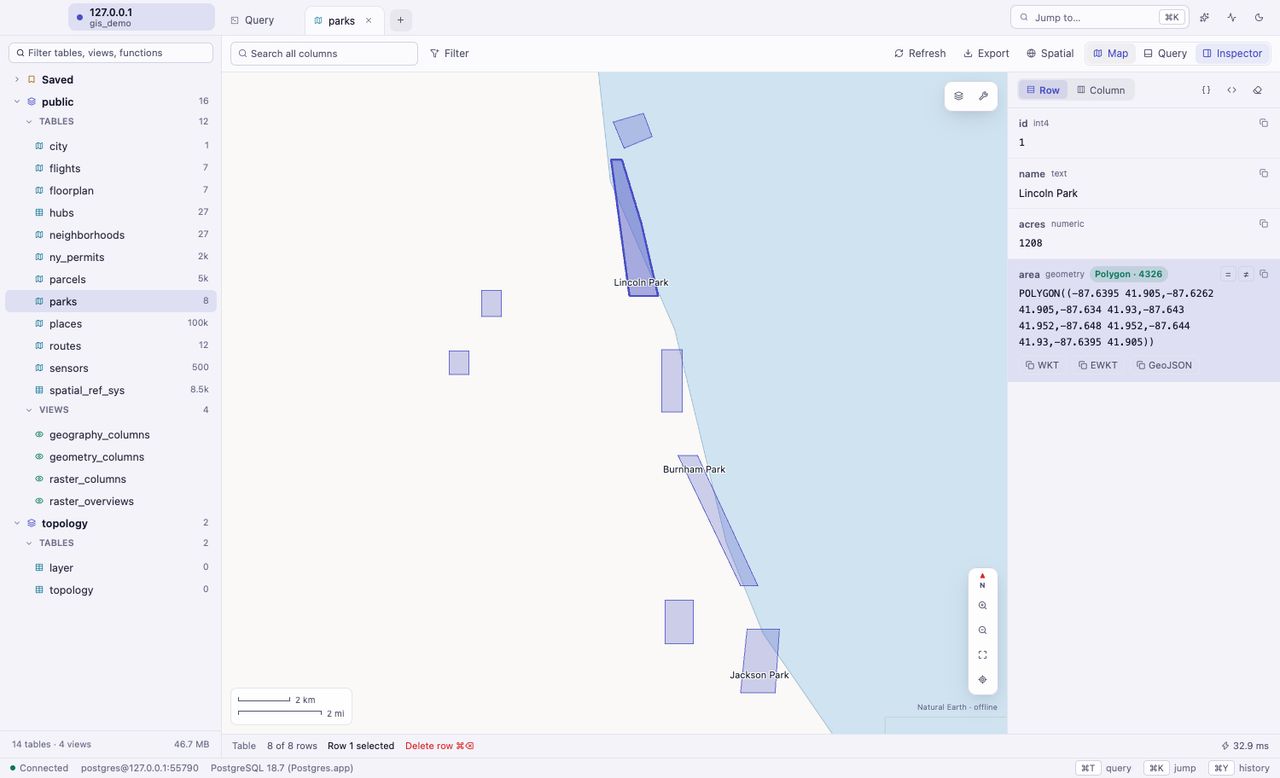
Hover a feature to see its row. Click it to select the row in the grid, and the other way around.
Pan, zoom, fit
Mouse wheel or pinch to zoom, drag to pan, fit to your data in one click, with a scale bar and live coordinates.
Offline basemap
Natural Earth land, water and borders are built in. Nothing about your data or your viewport leaves your Mac.
Ask a spatial question. See the answer.
Buffers, intersections, nearest neighbors and joins are a query away, and every result lands on the map. Iterate on the SQL and watch the shapes change.
- Ready-made spatial query templates to start from
- Spatial index use highlighted in query plans
- Readable geometry in every cell:
POINT (-87.68 41.89), not hex
PostGIS, without the tab of docs.
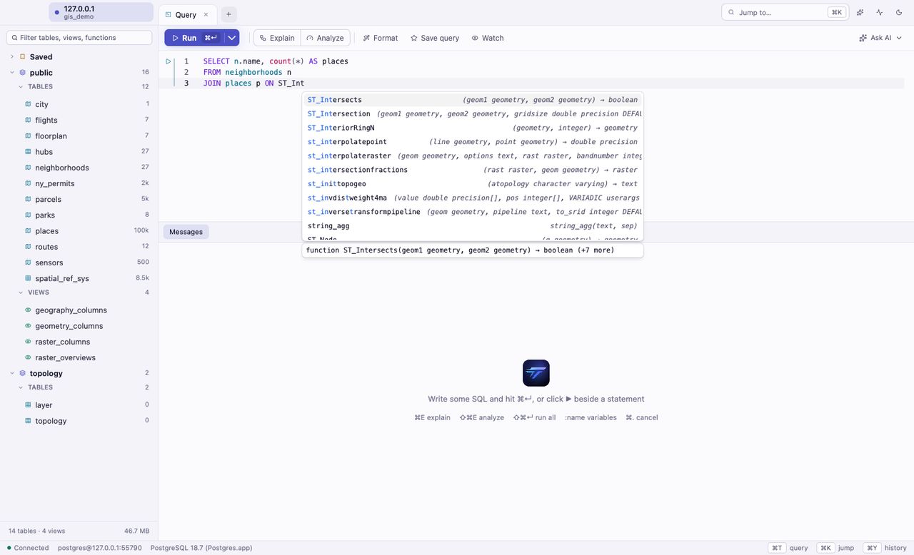
Every PostGIS function on your server in autocomplete, with its signatures and docs on hover.
Know your layers at a glance.
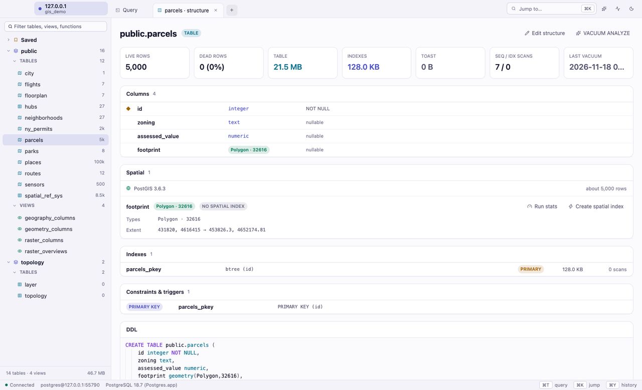
Every table shows its geometry types, SRIDs, extent and spatial indexes. When a large table has no spatial index, Tachyon says so and offers to create one, showing the SQL first.
- Geometry and geography columns marked in the sidebar
- WKT, EWKT and GeoJSON in the inspector
- Export any result as GeoJSON
Browse, edit, and see where it is.
Open a table and switch it to Map. The inspector shows the selected geometry in full, side by side with the grid.
People who think in coordinates.
GIS analysts
Check a layer, test a query and eyeball the result without leaving the SQL editor.
Backend engineers
Debug the geofence, the delivery radius or the nearest-store query with the shapes in front of you.
Data teams
Explore spatial tables next to the rest of your Postgres, with the same fast grid and charts.
Researchers and students
Learn PostGIS with docs on hover and instant feedback on a map. The free version has every feature.